Skip to content
home
About us
Industrial drones
Air Series
Drones for content creation
XY001
XY001
Air Series
Drones for content creation
XY002
XY002
Air Series
Drones for content creation
XY003
XY003
Air Series
Drones for content creation
XY004
XY004
Air Series
Drones for content creation
XY005
XY005
Air Series
Drones for content creation
XY006
XY005
Air Series
Drones for content creation
XY007
XY007
Air Series
Drones for content creation
XY008
XY008
Learn about all camera drones
Consumer Drones Comparison
Goggles Series Comparison
Find Authorized Retail Stores
solution
Solutions
Public Safety
Oil & Gas
Electricity
Aerial Surveying and AEC
Air Series
Drones for content creation
LZ001
LZ001
Air Series
Drones for content creation
LZ001
LZ001
Air Series
Drones for content creation
LZ001
LZ001
Air Series
Drones for content creation
LZ001
LZ001
Air Series
Drones for content creation
LZ001
LZ001
Air Series
Drones for content creation
LZ001
LZ001
Air Series
Drones for content creation
LZ001
LZ001
Air Series
Drones for content creation
LZ001
LZ001
Learn about all camera drones
Consumer Drones Comparison
Goggles Series Comparison
Find Authorized Retail Stores
drone countermeasures
Air Series
Drones for content creation
LZ001
LZ001
Air Series
Drones for content creation
LZ001
LZ001
Air Series
Drones for content creation
LZ001
LZ001
LZ001
Air Series
Drones for content creation
LZ001
LZ001
Air Series
Drones for content creation
LZ001
LZ001
Air Series
Drones for content creation
LZ001
LZ001
Air Series
Drones for content creation
LZ001
LZ001
Air Series
Drones for content creation
LZ001
LZ001
Learn about all camera drones
Consumer Drones Comparison
Goggles Series Comparison
Find Authorized Retail Stores
service and support
Product Support
How-to guides and technical help
Search by Product Series
Service Request and Inquiry
Service Request
More Info Inquiry
Service Plans
Comprehensive protection plans
Enterprise Equipment
More services
flight guide
Download Center
News
contact
X
Search
home
About us
Industrial drones
solution
drone countermeasures
service and support
News
contact
Search
Solution
home
Solution
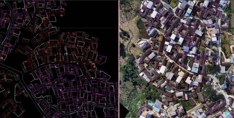
1.Basic Surveying and Mapping - Cadastral Surveying
Drones have significantly enhanced the efficiency of field data collection. The results of real-scene...
Read More
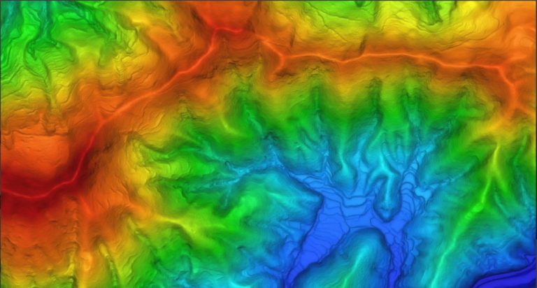
2.Basic surveying and mapping - Topographic surveying
Unmanned aerial vehicles can quickly conduct large-scale two-dimensional and three-dimensional models,...
Read More
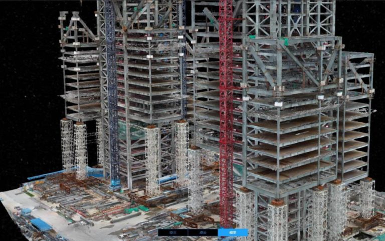
3. Engineering Surveying and Mapping - Survey and Design
Efficiently collect data, reduce field costs, and provide high-precision two-dimensional and three-dimensional...
Read More
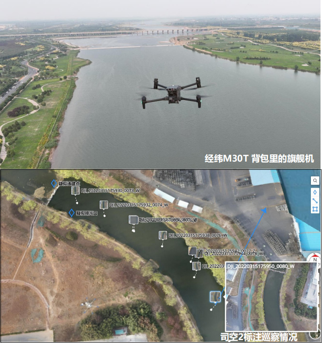
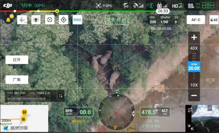
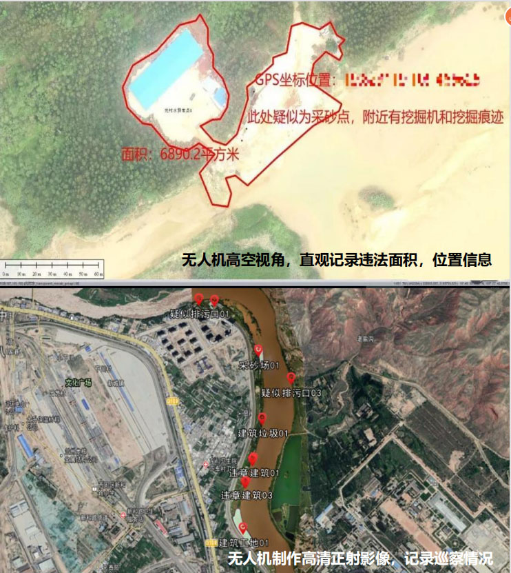
4. Water Administration Law Enforcement - River and Lake Inspection
Business Challenges: The water administration law enforcement department needs to record the sewage outlets,...
Read More
5. Forestry Application - Forest Area Patrol
Business Challenges: The forest environment is rather complex, and personnel cannot reach the scene quickly....
Read More
6. Forestry Application - Forest Fire Protection
Read More
7. Environmental Protection - Air Pollution Monitoring
Read More
No posts found