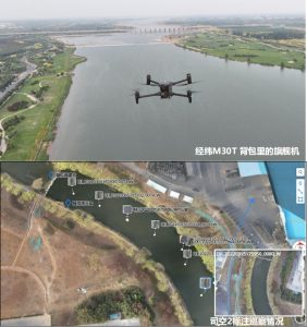
Drones have significantly enhanced the efficiency of field data collection. The results of real-scene models are directly displayed, making cadastral surveying and management more convenient
1. Business challenges
The speed of manual site registration measurement is slow, the efficiency is low, and the project cycle is long
The fieldwork is heavy and the labor cost is high
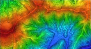
Traditional surveying and mapping results are limited to digital line drawings and cannot visually display the real scene effect of the plot
2. Advantages of drones
It can achieve 1:500 image-free mapping
• Efficient operation, the field collection efficiency is 5 to 10 times that of the traditional manual method
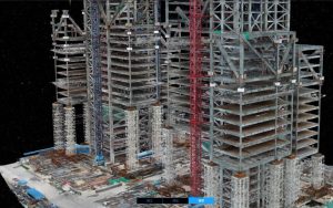
We can provide various results such as DOM, DSM, real-scene 3D models, and digital line drawing diagrams
3. Recommend a combination of solutions
• Hydrogen Peng XC02/ Sailor 6100X / 6/X4D