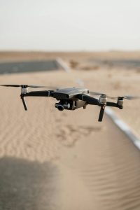
Uav mapping and 3D modeling: The UAV is equipped with high-resolution cameras and mapping equipment to quickly map a large area and generate 3D models through data processing software. It is widely used in urban planning, land surveying and mapping, archaeological research and other fields. For example, in urban planning, information such as urban terrain and building distribution can be quickly obtained through drone mapping to provide accurate data support for planning and design.
Drones for agricultural plant protection: Drones equipped with pesticide spraying systems can be used for farm plant protection operations. By precisely controlling the amount of spray and flight path, efficient and accurate pesticide spraying can be achieved, reducing pesticide waste and environmental pollution, while reducing manual labor intensity. In addition, drones can also be used to carry multi-spectral cameras to monitor crops, timely find problems such as pests and diseases and nutritional deficiencies, and achieve precise fertilization and medicine application.
Drone logistics distribution: Some companies are exploring the use of drones for logistics distribution, especially in remote areas or places with poor transportation. Drones can quickly and flexibly deliver goods to their destinations, improving delivery efficiency. For example, in some mountains or islands, drones can deliver medicines, daily necessities and other materials in time.
Drone show: Multiple drones form a formation and perform a light show through precise programming and control. This new form of performance is highly flexible and creative, and can be used for large-scale events, festivals and other occasions to bring shocking visual effects to the audience. For example, at the opening ceremonies of some major sporting events, drone performances can create spectacular scenes.
Drone search and rescue: In natural disasters or emergency rescue scenarios, drones can play an important role. Drones equipped with thermal imagers, cameras and other equipment can quickly search the affected area, find the location of trapped people, provide accurate information for rescuers, and improve rescue efficiency.
Uav and virtual reality (VR)/augmented reality (AR) combination: real-time images captured by drones are transmitted to VR or AR devices, allowing users to experience the flight perspective as if immersive, or overlay the information captured by drones in the real scene to provide a richer interactive experience. For example, in the field of tourism, visitors can enjoy the full view of scenic spots through VR devices with the help of the perspective of drones.